In an era dominated by digital navigation tools, there's something profoundly engaging about a handcrafted illustrated map. These artistic creations don't just show you where to go—they invite you to explore, discover, and connect with a place on a deeper level. Today, we're taking you behind the scenes of creating an illustrated study tour map of Hunan province, a project that transforms educational itineraries into visual storytelling.
The Art of Educational Mapping
Illustrated maps occupy a unique space between functional tools and artistic expression. When designed for educational purposes, they become powerful visual narratives that prepare travelers for both the physical journey and the cultural experiences awaiting them.
The Hunan Study Tour map exemplifies this balance—highlighting key educational landmarks while visually immersing viewers in the province's rich cultural heritage. Before students and scholars even set foot in Hunan, they begin to understand the geographical and cultural context of their educational adventure.
The Client Consultation Process
Every meaningful illustrated map begins with understanding its purpose. For the Hunan Study Tour map, this meant in-depth conversations with educational organizers to identify:
- Educational objectives of the study tour
- Target audience: International students and scholars interested in Hunan's educational and cultural heritage
- Key narrative elements that connect historical and modern educational institutions
- Essential landmarks that tell the story of Hunan's academic legacy
This consultation phase ensures that the final map serves both practical navigation needs and deeper educational purposes.
Mapping the Educational Landscape
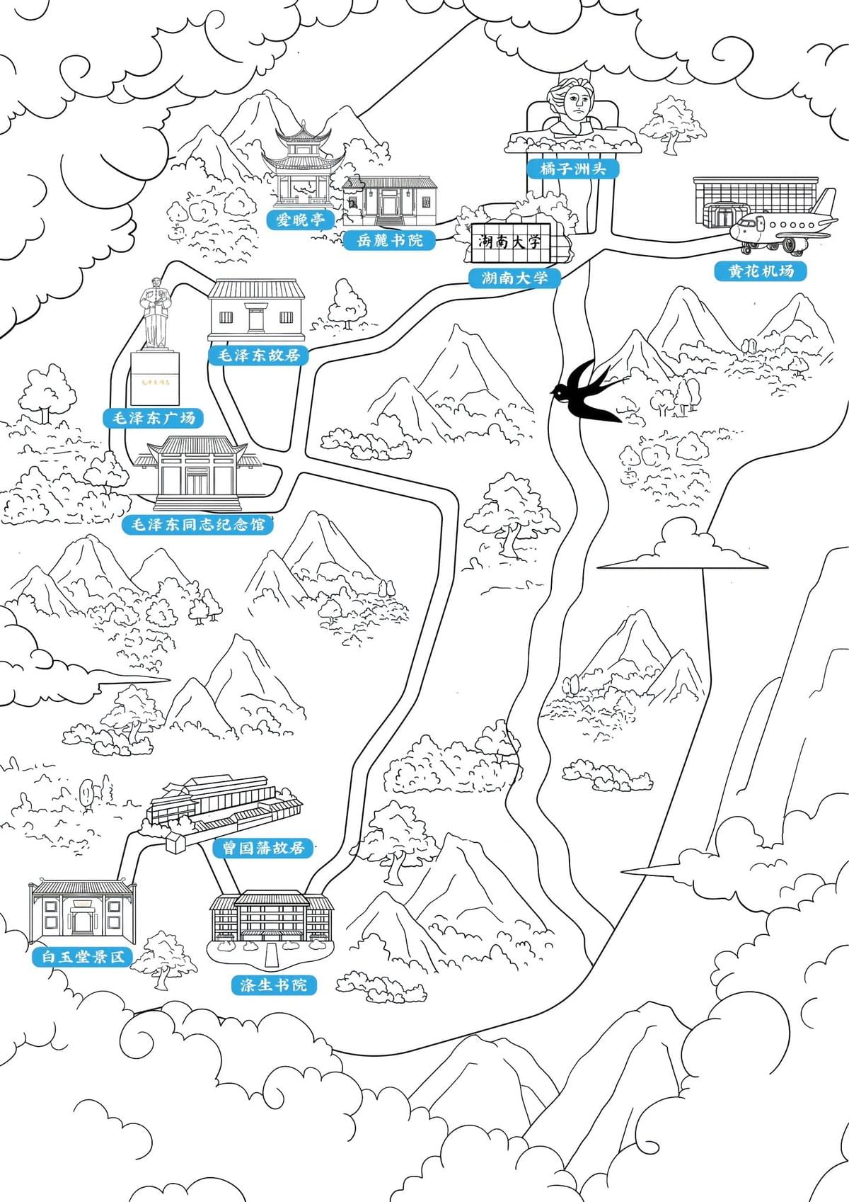
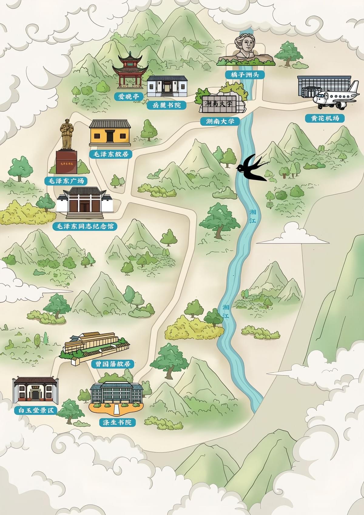
The heart of any educational tour map lies in its careful selection of locations. For Hunan province, these included:
- Historical academic institutions like the ancient Yuelu Academy and Qisheng Academy
- Modern educational facilities including Hunan University
- Cultural landmarks such as Mao Zedong's Former Residence and Memorial Hall
- Natural features like Orange Island and the winding Xiang River
- Transportation hubs including Huanghua Airport
Each location was selected not just for its navigational importance but for its contribution to the educational narrative of Hunan's rich scholarly tradition.
Artistic Choices: Where Tradition Meets Modern Design
Creating a visually compelling map requires thoughtful artistic decisions that respect cultural context while serving modern educational needs. For the Hunan map, this meant:
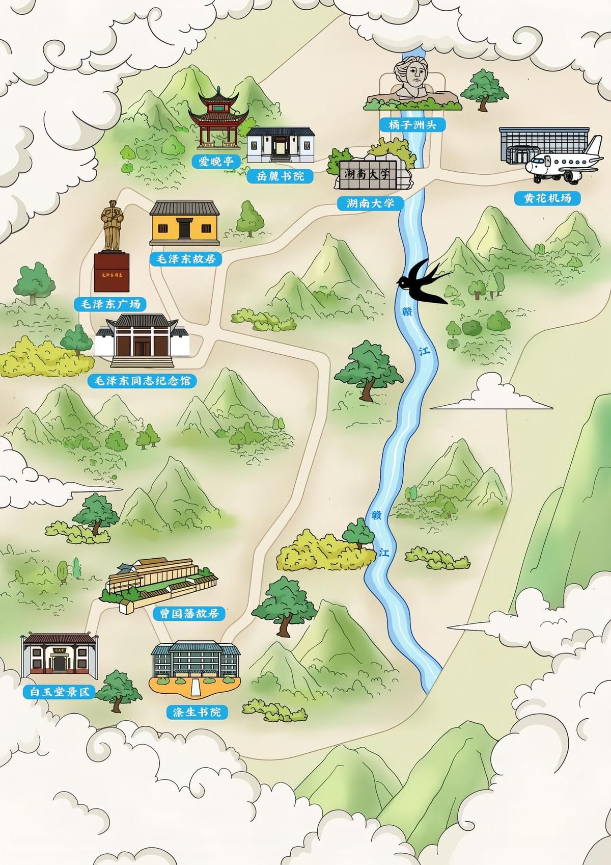
Color Palette
- Soft greens representing mountains and natural landscapes
- Gentle blues highlighting the Xiang River—the geographical backbone of the tour
- Muted earth tones for historical buildings, reflecting traditional architecture
- Strategic use of contrast to emphasize key landmarks
Illustrative Style
The map embraces a distinctive aesthetic that bridges traditional Chinese landscape painting techniques with contemporary illustration:
- Stylized mountains rendered with gentle curves reminiscent of classical Chinese art
- Architectural landmarks depicted with attention to distinctive features
- Traditional elements like decorative clouds that frame the composition
- Simplified forms that maintain visual clarity while honoring artistic tradition
Technical Execution: From Concept to Creation
The journey from concept to finished map involves multiple stages of technical development:
- Initial research and geographical accuracy - Ensuring the spatial relationships between locations maintain sufficient accuracy while allowing for artistic interpretation
- Preliminary sketches - Developing the overall composition and flow
- Landmark illustrations - Creating distinctive miniature illustrations for each key location
- Integration of natural elements - Adding mountains, rivers, and landscape features
- Navigation pathways - Designing clear routes that connect educational sites
- Labeling system - Developing information tags with both English and Chinese characters
- Final refinement - Balancing all elements for both aesthetic appeal and functional clarity
Educational Considerations: Beyond Simple Navigation
What elevates this map from simple direction-giving to educational tool is its thoughtful consideration of learning objectives:
- Geographical context - The map contextualizes historical sites in relation to natural geography, helping students understand how landscape shaped development
- Historical continuity - By including both ancient academies and modern institutions, the map highlights the evolution of Hunan's educational tradition
- Cultural narrative - The visual journey follows the Xiang River, the same path that has connected scholars and ideas throughout Hunan's history
- Visual preparation - Students can mentally picture destinations before arrival, enhancing their readiness to engage with physical locations
The Final Product: More Than a Map
The completed Hunan Study Tour map transforms a simple itinerary into a visual story. Before students even begin their physical journey, they've already embarked on a mental exploration of Hunan's educational landscape.
The illustrated map serves multiple purposes:
- Practical orientation for visitors navigating between sites
- Cultural context that enriches the educational experience
- Memorable keepsake that commemorates the educational journey
- Teaching tool that visualizes the connections between historical sites and modern institutions
Conclusion: Mapping as Storytelling
In creating a handcrafted study tour map of Hunan province, we're not simply plotting points on paper—we're weaving together geography, history, education, and art into a cohesive visual narrative. The map becomes both the introduction and the souvenir of the educational journey.
While digital maps efficiently get us from point A to point B, illustrated maps like this one transport us into the cultural heart of a destination. They remind us that education isn't just about reaching destinations but about understanding the connections between them—connections that span across both physical landscapes and centuries of scholarly tradition.
For students embarking on the Hunan Study Tour, their journey begins not when they arrive at Huanghua Airport, but in the moment they first unfold this map and begin to trace the path of scholars who came before them.