Introduction
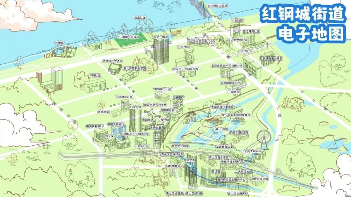
In a world dominated by digital navigation tools, custom illustrated maps stand out as both practical guides and captivating works of art. The talented team at Mapful.Art has mastered the delicate balance between geographical accuracy and artistic expression, creating bespoke illustrated maps that tell the unique stories of places around the world. One of their standout projects—the vibrant illustrated map of Honggang City Street (红钢城街道)—offers a perfect window into their creative process and artistic philosophy. This case study takes you behind the scenes of how a blank canvas transforms into a charming, functional piece of cartographic art.
The Client Consultation: Understanding Place and Purpose
Every great map begins with understanding its purpose. When approaching the Honggang City Street project, the Mapful.Art team conducted extensive client consultations to uncover:
- The map's primary function as both a tourism tool and community resource
- Key landmarks that define the area's identity and daily life
- The desired aesthetic that would capture the area's unique character
- Target audience considerations, from local residents to first-time visitors
These initial conversations shaped everything from scale decisions to stylistic choices, ensuring the final product would serve its intended purpose while delighting its users.
Research and Planning: The Foundation of Accuracy
Before a single illustration line was drawn, the team immersed themselves in understanding Honggang City Street:
- Compiling comprehensive geographical data and satellite imagery
- Conducting on-site visits to experience the area firsthand
- Identifying and prioritizing landmarks, from historic buildings to modern facilities
- Creating a hierarchical structure of visual elements based on importance
This research phase established the crucial framework that would allow artistic liberty while maintaining geographical integrity—a hallmark of Mapful.Art's approach.
Stylistic Development: Defining the Visual Language
The distinctive aesthetic of the Honggang City Street map didn't happen by accident. The team carefully crafted:
- A cheerful, cartoon-like illustration style that made the map approachable
- A signature bird's-eye perspective that balances accuracy with artistic representation
- A vibrant color palette featuring blues for water, greens for parks, and distinctive colors for key buildings
- Visual motifs that would remain consistent throughout the illustration
This stage transformed raw geographical data into a cohesive visual language that would guide the entire illustration process.
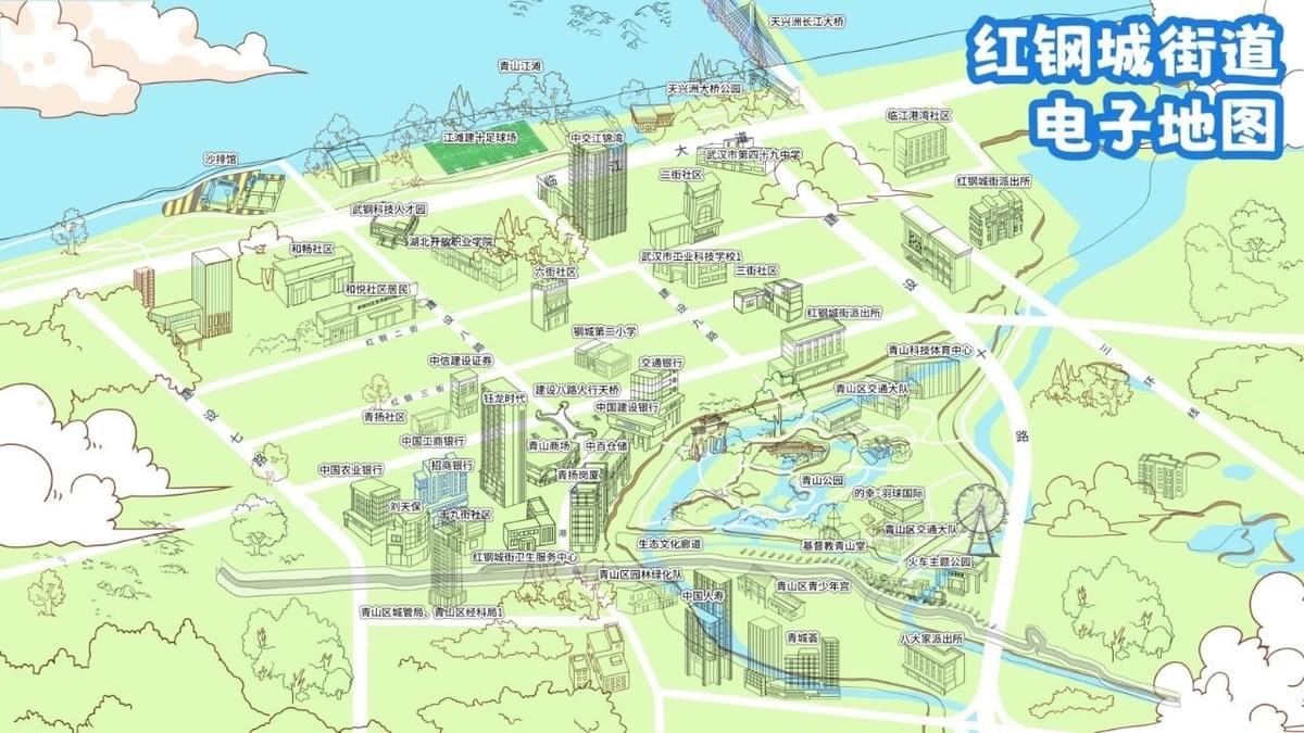
The Illustration Journey: Where Art Meets Geography
With planning complete, the artists at Mapful.Art began bringing Honggang City Street to life:
- Initial sketches were hand-drawn based on the geographical framework
- The artwork was digitized and refined, incorporating the rounded, friendly architectural style
- Playful elements like boats on the river and decorative trees were added to enhance visual interest
- Environmental details such as clouds and texture variations created depth and dimension
Each illustrated element was carefully considered—not just for aesthetic appeal, but for how it would contribute to the map's utility and readability.
Information Design: Balancing Detail and Clarity
Perhaps the greatest challenge in illustrated map creation is incorporating necessary information without compromising artistic integrity:
- Location labels were designed with clear, legible typography that complemented the illustration style
- Information density was carefully calibrated to prevent visual overwhelm
- Critical facilities like schools, banks, and medical centers received appropriate visual prominence
- Color coding and iconography created intuitive information hierarchies
This delicate balance ensured that the map remained as functional as it was beautiful—a guiding principle for all Mapful.Art creations.
Digital Optimization: Preparing for Multiple Platforms
The final stage involved preparing the illustrated masterpiece for various applications:
- Finalizing the electronic version with appropriate resolution for different viewing platforms
- Adding the branded title "红钢城街道电子地图" in a distinctive blue bubble
- Ensuring color accuracy across digital and print applications
- Creating scaled versions for different usage scenarios without losing detail integrity
Conclusion
The Honggang City Street illustrated map exemplifies how Mapful.Art transforms geographical information into visual storytelling. By combining rigorous research with artistic vision, they've created more than just a navigation tool—they've crafted a visual celebration of place that invites exploration and deepens connection to the community it represents.
This approach to custom map creation demonstrates why illustrated maps continue to hold special value in our digital age. They don't just show us where things are; they show us why places matter, capturing the character and charm that makes each location unique. For communities like Honggang City Street, these illustrated maps become cherished visual documents that celebrate identity while serving practical purposes—a perfect marriage of art and function.
For those considering a custom illustrated map for their community, business, or special event, the Mapful.Art case study reveals the depth of consideration and craftsmanship that goes into creating these geographical works of art. The result isn't just a map—it's a visual story waiting to be explored.