Introduction
In the digital age, beautifully crafted physical maps have become rare treasures that enhance the tourist experience in ways GPS simply cannot. At the intersection of cartography, art, and cultural storytelling lies the work of Mapful.art—a team dedicated to creating custom tourist maps that are both functional navigational tools and cherished keepsakes. Today, we take you behind the scenes of their creative process through the lens of one of their standout projects: the Iron Tower (铁塔) Scenic Area map.
Client Consultation: Understanding the Essence of Place
Every successful map begins with deep understanding. The Mapful.art team initiates their projects with comprehensive client consultations that go beyond basic logistics. For the Iron Tower Scenic Area project, this meant:
- In-depth discussions with management about visitor demographics and their specific wayfinding challenges
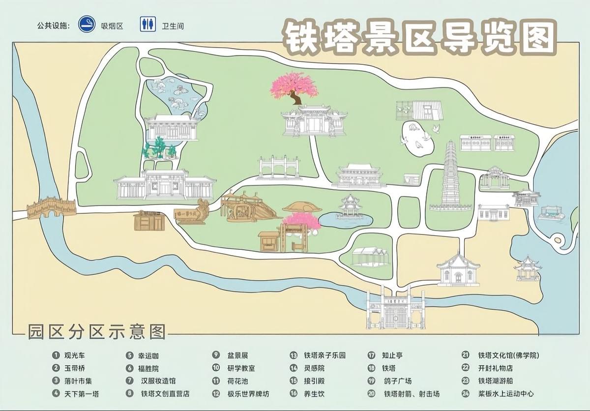
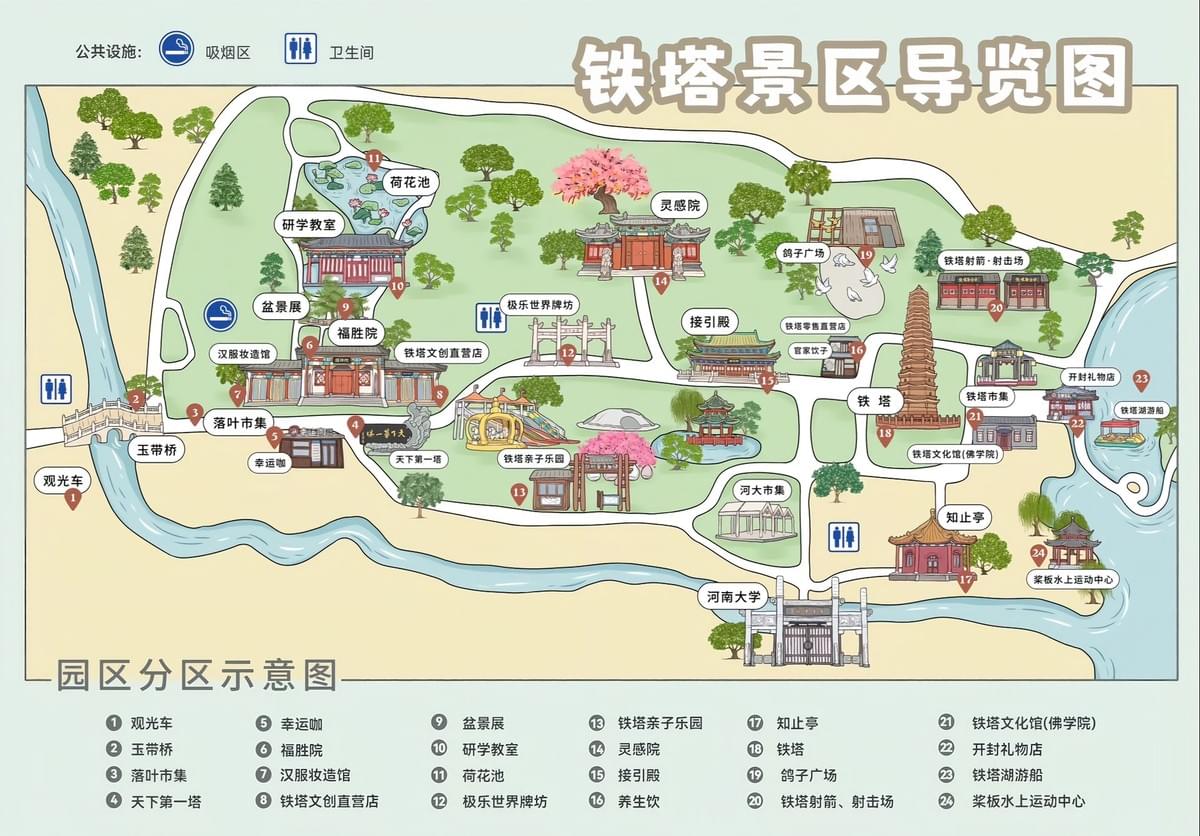
- Identifying priority attractions requiring prominence, including the iconic iron tower itself, historic temples, and key activity areas
- Mapping essential visitor amenities like toilets and designated smoking areas
- Developing an aesthetic direction that honors the site's cultural significance and architectural heritage
These consultations aren't merely about gathering information—they're about capturing the spirit of a location that will eventually translate into visual storytelling.
Design Development: Where Accuracy Meets Artistry
With client insights in hand, the Mapful.art designers began their creative journey for the Iron Tower map through several intentional design choices:
- Thoughtful Color Selection: A warm, inviting palette featuring soft beige backgrounds creates a historical feel, while vibrant green spaces highlight natural elements.
- Distinctive Illustration Style: The hand-drawn approach balances geographical accuracy with artistic charm, making the map both useful and visually appealing.
- Architectural Authenticity: Buildings are rendered with faithful attention to traditional Chinese architectural elements, preserving cultural integrity.
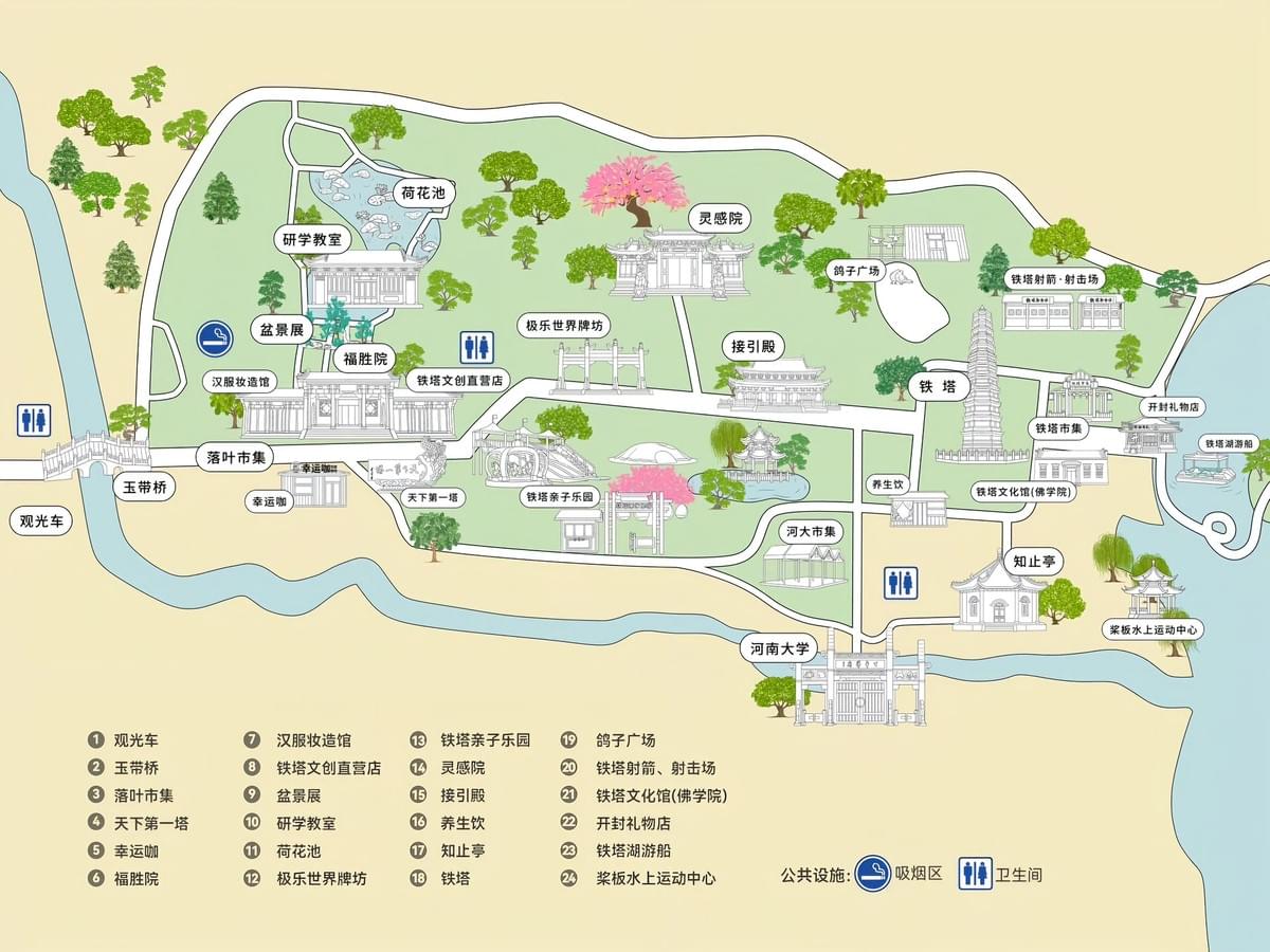
- Dimensional Perspective: Rather than using flat symbols, the 3D perspective drawing technique gives visitors a more intuitive sense of the environment they'll navigate.
- Atmospheric Details: Additions like cherry blossoms and decorative trees aren't just aesthetic choices—they help visitors identify landmarks and enhance the overall sense of place.
Technical Production: From Concept to Final Map
Creating a map like the Iron Tower Scenic Area guide involves rigorous technical processes:
- Foundation Mapping: Initial sketches based on accurate GPS coordinates and satellite imagery establish the geographical foundation.
- Digital Artistry: Professional illustration software transforms sketches into refined, detailed representations.
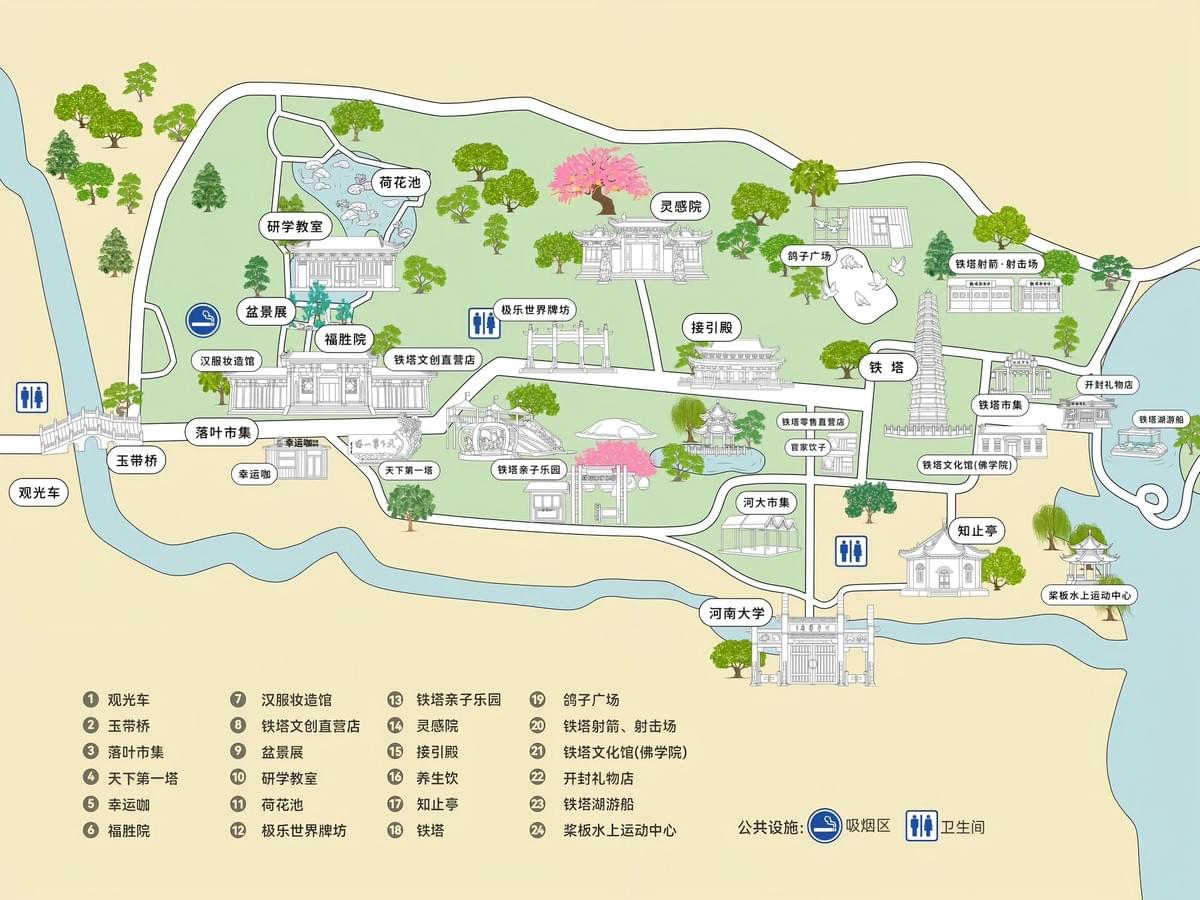
- Stakeholder Review Cycles: Multiple reviews with Iron Tower management ensure both accuracy and alignment with visitor needs.
- Information Layer Integration: The careful placement of labels, legend items, and amenity markers balances information density with visual clarity.
- Format Optimization: Final adjustments ensure the map performs equally well in digital environments and physical print.
Special Features: The Thoughtful Details That Matter
What elevates the Iron Tower map from functional to exceptional are its thoughtfully integrated features:
- Visual Hierarchy: Strategic use of size and detail draws visitor attention to landmark buildings and primary attractions first.
- Natural Orientation Aids: Water features like rivers serve dual purposes—they're both attractions and natural reference points for orientation.
- Intuitive Legend System: A simple numbered approach makes reference quick and stress-free for international visitors.
- Clear Pathway Guidance: Carefully rendered pathways show not just where visitors can go, but suggest optimal circulation through the site.
- Attraction Differentiation: Subtle visual cues help distinguish between different types of attractions, allowing visitors to prioritize based on their interests.
Conclusion: Maps as Memory-Makers
The finished Iron Tower Scenic Area map represents more than geographical information—it provides visitors with a mental picture of destinations before they arrive, making navigation more intuitive and memorable than standard cartographic approaches. In a world of digital navigation, Mapful.art's illustrated maps serve as both practical guides and cherished souvenirs that capture the essence of place.
These artfully crafted maps transform the simple act of wayfinding into an extension of the travel experience itself, proving that in the right hands, a map can be both a tool for discovery and a work of art worthy of display long after the journey ends.