Introduction
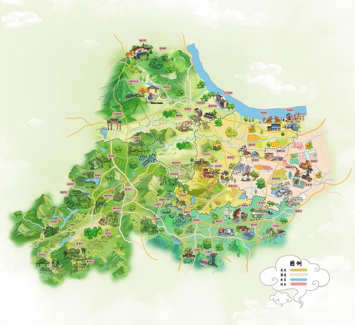
In the world of cartography, there exists a beautiful intersection between geographical precision and artistic expression. The Huzhou Rural Villages hand-drawn map created by the Mapful.art team exemplifies this perfect balance—combining accurate spatial representation with charming illustrated elements that bring the region's character to life. This stunning visual guide not only serves as an operational map highlighting key villages but also stands as a work of art that captures the essence and beauty of Huzhou's rural landscape. In this blog post, we'll take you behind the scenes to explore the meticulous process that transformed geographical data into this visually captivating cartographic masterpiece.
The Client Consultation Journey
Understanding the Vision
The creation of any custom map begins with a thorough understanding of client needs. The Mapful.art team initiated their process by conducting in-depth consultations to define the project parameters:
- They identified the map's primary purpose: showcasing key operational villages in Huzhou
- They determined the geographical boundaries to be represented
- They compiled a list of villages that required prominent featuring
- They discussed artistic direction, including style preferences and color palette
- They established what supplementary information needed inclusion (landmarks, transportation routes, water bodies)
This initial phase laid the crucial groundwork for the project, ensuring that the final product would meet both practical and aesthetic requirements.
Research and Planning: The Foundation of Accuracy
Gathering Geographical Intelligence
Before putting pen to paper (or stylus to tablet), the team embarked on comprehensive research to ensure geographical accuracy:
- They collected detailed geographical data about Huzhou's rural landscape
- They studied architectural features unique to each highlighted village
- They analyzed the region's topography, paying special attention to mountains and waterways
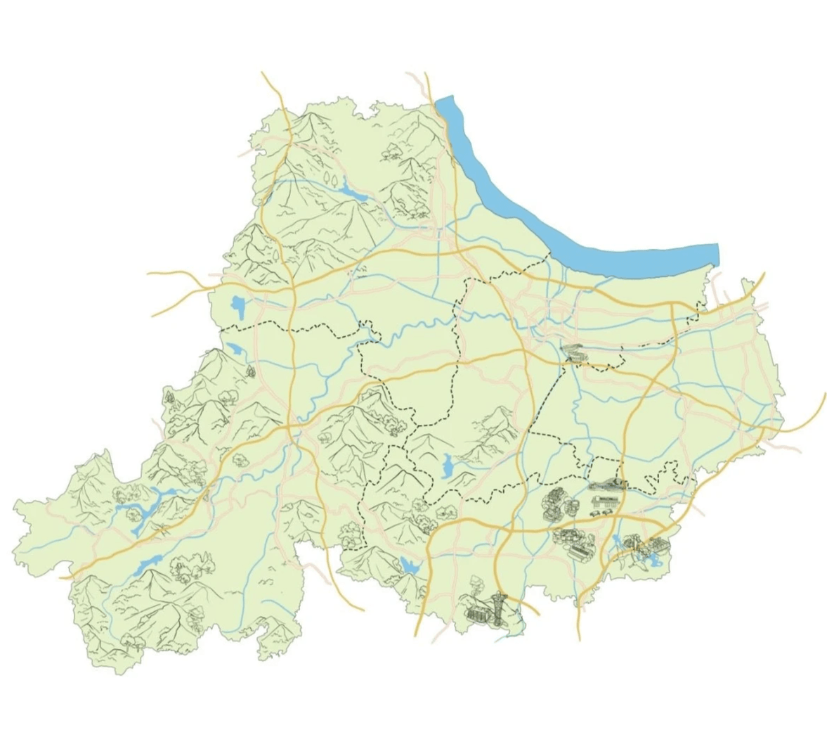
- They created a precisely scaled base map as their foundation
- They plotted the relative positions of key landmarks and villages
This research phase was critical in maintaining the map's functionality while preparing for its artistic transformation.
The Design and Illustration Process
Building Layer by Layer
The transformation from geographical data to illustrated map involved several carefully executed stages:
Base Layer Development
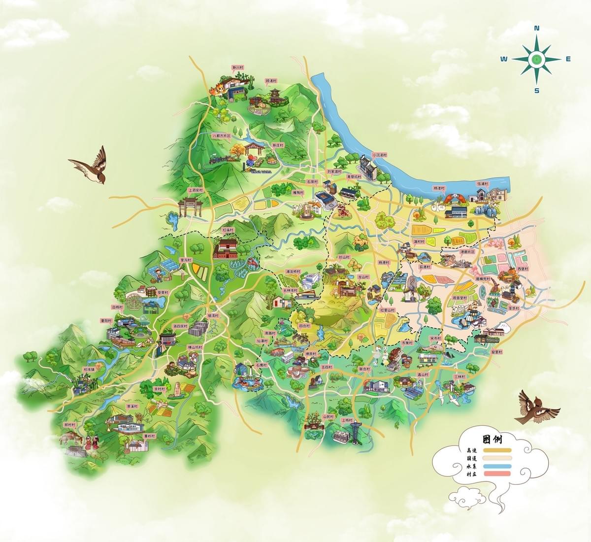
The artists began by establishing the soft green backdrop that would serve as the foundation for all other elements, outlining primary topographical features and positioning the compass rose for orientation.
Terrain Visualization
With the base established, the team rendered the mountainous regions using varying shades of green to create depth and dimension. The flowing blue river was illustrated with careful attention to its natural course, and various textures were applied to differentiate terrain types.
Infrastructure Integration
Connecting the villages, yellow and orange pathways were drawn to represent roads and travel routes, with clear boundaries established between different areas and jurisdictions.
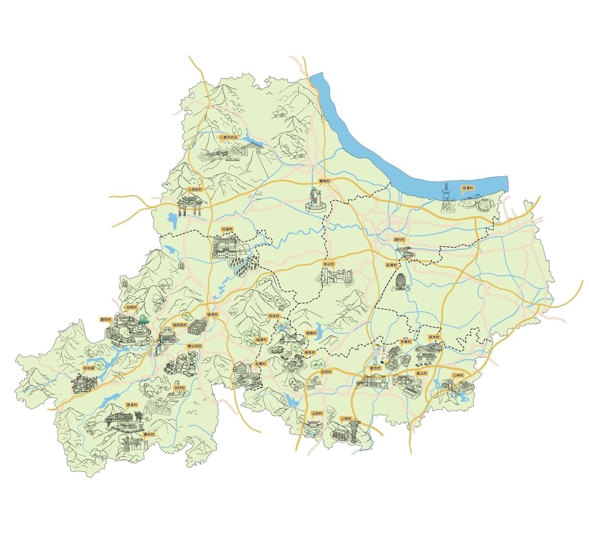
Landmark Illustration
Each village received special attention with miniature architectural illustrations that captured their distinctive characteristics. The artists maintained a consistent artistic style while ensuring each location remained visually unique and recognizable.
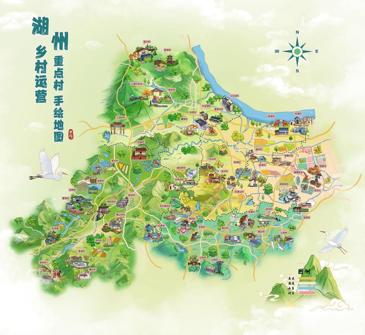
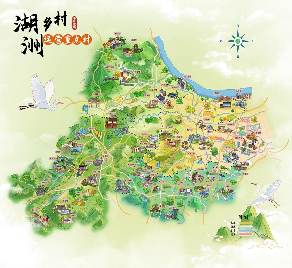
Text and Labeling
Chinese labels were thoughtfully positioned to identify each village location without obscuring important visual elements. The title "湖州重点村手绘地图 湖乡村运营" (Hand-drawn map of key villages in Huzhou's rural operations) was prominently placed.
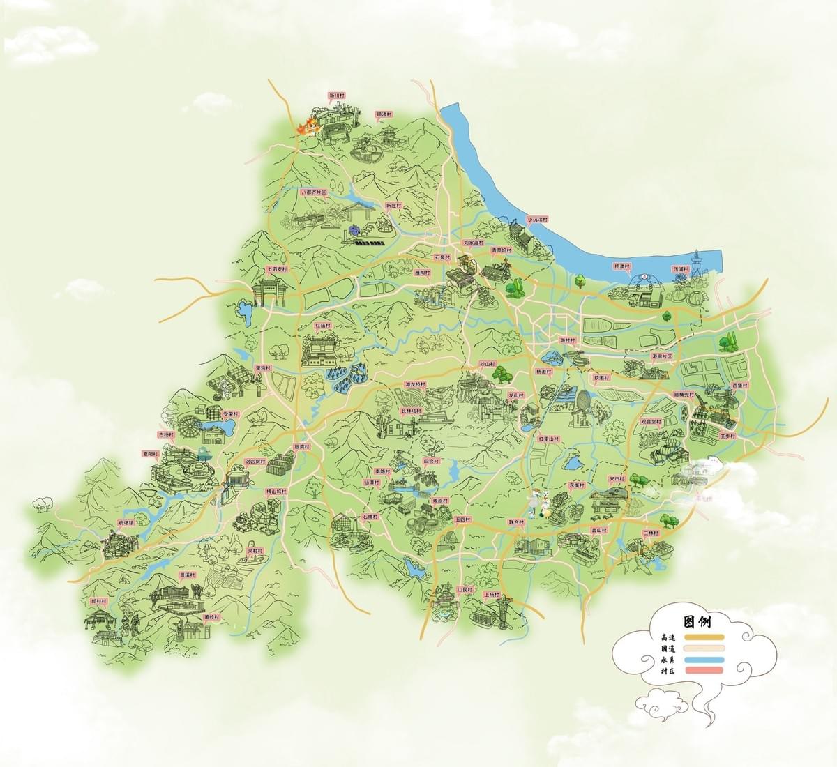
Decorative Flourishes
To enhance the map's aesthetic appeal, white cranes were added as decorative elements, a legend was positioned in the bottom right corner, and the overall composition was carefully balanced.
Technical Implementation
Digital Artistry in Action
Despite its hand-drawn appearance, the map was created using sophisticated digital techniques:
- Professional illustration software provided the technical foundation
- Drawing tablets enabled the authentic hand-drawn aesthetic
- GIS (Geographic Information Systems) data ensured accurate spatial positioning
- A layer-based workflow organized the various map elements
- Custom digital brushes achieved the watercolor-like effects
- Digital coloring techniques maintained consistency throughout the illustration
This blend of traditional artistic techniques and modern digital tools resulted in the map's distinctive visual character.
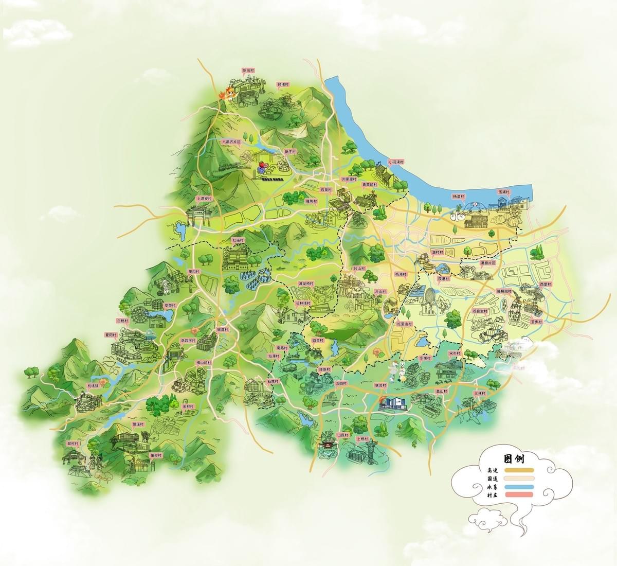
Finalization and Delivery
Perfecting the Details
Before delivering the final product, the Mapful.art team conducted thorough quality assurance:
- They reviewed the map for geographical accuracy and completeness
- They verified that all requested villages were properly represented
- They checked all labels for correct placement and spelling
- They optimized the digital files for various usage scenarios (print media, digital display)
- They prepared versions at different resolutions to accommodate various needs
Conclusion
The Huzhou Rural Villages hand-drawn map stands as a testament to the Mapful.art team's expertise in blending geographical precision with artistic expression. By following a methodical process from consultation through research, design, implementation, and finalization, they created not just a functional operational map but a visual celebration of Huzhou's rural landscape.
What makes this map truly special is how it transforms complex geographical information into an accessible, engaging visual narrative. The charming illustrations invite viewers to explore the region while the accurate spatial relationships ensure practical usability. In a world increasingly dominated by sterile digital maps and GPS navigation, this hand-drawn creation reminds us of cartography's rich artistic heritage and its power to connect people with places through beauty as well as function.
The Mapful.art team has demonstrated that in the right hands, maps can be much more than navigational tools—they can be windows into the cultural and geographical soul of a region, crafted with care to delight as well as inform.