Introduction
In the world of travel, a well-crafted map does more than just guide—it tells a story, inspires exploration, and transforms complex geography into accessible art. The illustrated tourist map of Zhangjiajie's Yongding District created by the Mapful.Art team exemplifies this perfect blend of functionality and artistic expression. But how exactly does a professional cartography team create such an intricate, informative, and visually appealing map? This blog post takes you behind the scenes of the map-making process, revealing the meticulous steps from client briefing to final delivery.
The Client Requirement Process
Every great map begins with clear objectives. For the Zhangjiajie Yongding District map, the Mapful.Art team started with comprehensive client consultations to establish:
- Purpose definition: Creating a visual guide for tourists navigating the natural wonders and cultural sites of Yongding District
- Audience identification: Both international and domestic tourists with varying familiarity with the region
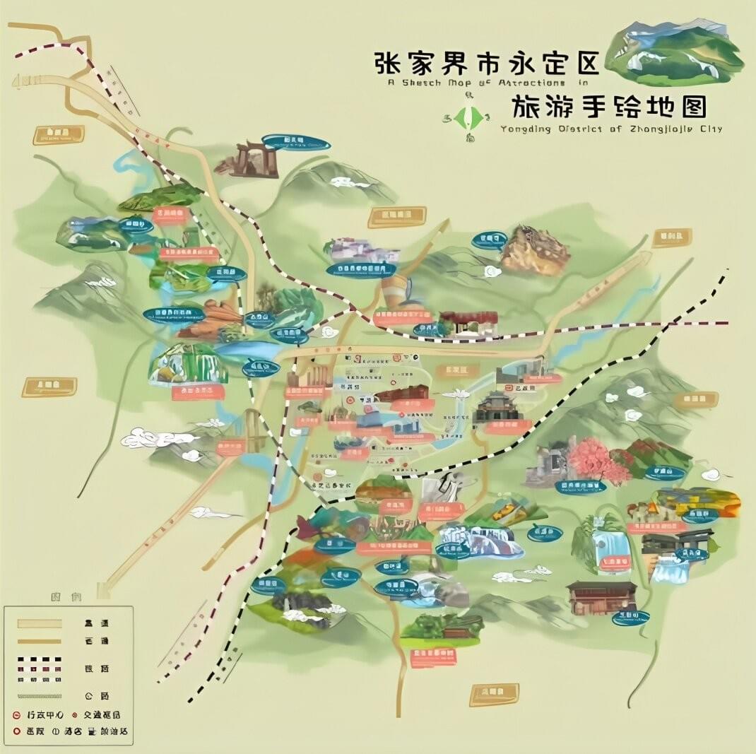
- Language requirements: Bilingual presentation in Chinese and English to serve the global tourism market
- Visual style determination: A colorful, illustrated approach that highlights the area's dramatic landscapes while maintaining geographical clarity
This initial phase sets the foundation for every decision that follows, ensuring the final product meets both aesthetic standards and practical needs.
Research and Information Gathering
Before a single line is drawn, exhaustive research forms the backbone of accurate cartography:
- Landmark identification: The team catalogs all significant attractions, from the famous pillar-like mountains to cultural sites and visitor facilities
- Geographic accuracy: Base maps and geographic data are obtained to ensure proper spatial relationships while allowing for artistic interpretation
- Attraction classification: Sites are categorized by type to inform the visual hierarchy and legend development
- Transportation mapping: Main roads, trails, and public transport routes are identified to help visitors plan their journeys effectively
For Zhangjiajie, this research phase was particularly crucial due to the complex topography and the numerous scattered attractions throughout the district.
Design and Illustration Process
The distinctive visual style of the Zhangjiajie map showcases several techniques that balance artistry with functionality:
- Stylized topography: The region's famous karst mountains are rendered in a semi-3D illustrated style with gentle color gradients that convey elevation while maintaining visual clarity
- Strategic color coding: Cool blues for water features, varied greens for natural areas, and warmer tones for built environments create intuitive visual categories
- Custom iconography: Bespoke pictorial icons represent different types of attractions, from natural wonders to cultural sites and visitor amenities
- Bilingual integration: All key locations are labeled in both Chinese and English, with careful typography that ensures readability without overwhelming the visual elements
The map's distinctiveness comes from its balanced approach—detailed enough to be practical but stylized enough to be engaging and memorable.
Technical Execution
Creating such a complex map involves several technical stages:
- Initial sketching: Hand-drawn layouts establish the basic geographic relationships and composition
- Digital refinement: Sketches are transformed using professional illustration software, allowing for precision and layers of information
- Color application: The carefully selected palette is applied to differentiate features and enhance visual hierarchy
- Label placement: Text elements are strategically positioned to ensure readability while minimizing overlap with important visual elements
- Legend development: A comprehensive yet accessible legend is created to help visitors interpret the map's symbols and color coding
Each stage involves multiple revisions and quality checks to ensure accuracy and visual coherence.
Final Production and Delivery
The completed Zhangjiajie Yongding District map was prepared for multiple uses:
- Digital formats for websites, mobile applications, and electronic distribution
- Print-ready files for physical tourist maps, brochures, and guidebooks
- Large-format versions for display at visitor centers and tourist information points
This versatility ensures the map serves tourists at every stage of their journey—from pre-trip planning to on-site navigation.
Conclusion
The Zhangjiajie Yongding District map exemplifies how professional cartography transcends mere geographic representation to become both a practical tool and an artistic interpretation of place. Through meticulous research, thoughtful design choices, and technical expertise, the Mapful.Art team created a map that not only guides tourists through a complex landscape but also captures the essence and beauty of this remarkable region.
The bilingual approach and clear visual hierarchy make this map particularly valuable in China's international tourism context, demonstrating how illustrated maps can bridge cultural and language barriers while enhancing the overall visitor experience. In an age of digital navigation, these artfully crafted maps continue to offer something GPS cannot—a sense of place, context, and inspiration that turns a trip into an adventure.