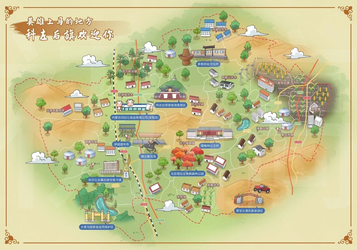
In the vast grasslands of Inner Mongolia lies Kezuohouqi (Horqin Left Back Banner), a region where traditional Mongolian culture meets modern development. Creating a tourism map for such a unique location requires more than geographical accuracy—it demands cultural sensitivity, artistic vision, and practical functionality. Join us as we journey through the creative process behind the Mapful.art team's hand-drawn tourism map that brings this remarkable region to life.
The Journey Begins: Initial Client Consultation
Every great map starts with understanding its purpose. When commissioned to create the Kezuohouqi tourism map, our team first sat down with local tourism officials to grasp the region's essence. During these initial meetings, we explored:
- The region's unique identity as a place where Mongolian heritage harmonizes with contemporary development
- The welcoming spirit captured in the banner's greeting: "英雄上马的地方,科左后旗欢迎你" ("The place where heroes mount horses, Kezuohouqi welcomes you")
- Key attractions that showcase both cultural significance and tourist appeal
- The desired aesthetic—warm and inviting while honoring traditional Mongolian visual elements
These conversations provided the foundation for a map that would not just guide visitors but tell the story of Kezuohouqi.
Digging Deeper: Research and Data Collection
With direction established, our team immersed ourselves in comprehensive research:
- We obtained official geographic layouts of the banner territory, studying its natural contours and boundaries
- We delved into the rich Mongolian cultural heritage, identifying sites of historical and cultural significance
- Natural features were cataloged, from sweeping grasslands to water features that shape the landscape
- Tourist infrastructure was mapped, ensuring visitors would easily find accommodations and transportation
- Both traditional structures (like the iconic yurts) and modern buildings were studied to ensure authentic representation
- Special elements unique to Kezuohouqi, including wind farms and horse riding areas, were noted for inclusion
This research phase transformed abstract concepts into concrete elements ready for visual interpretation.
Finding the Visual Voice: Design Concept Development
Armed with research, our designers developed a visual approach that would honor Kezuohouqi's character:
- We created a style guide featuring a warm, pastoral aesthetic with soft colors reflecting the grassland environment
- Our color palette embraced earthy beiges for terrain, gentle greens for vegetation, and traditional colors for cultural elements
- A decorative border with ornamental corners was designed, drawing inspiration from traditional Chinese artistic frameworks
- We established an information hierarchy that balanced artistic appeal with practical tourist guidance
- Mongolian motifs—yurts, horses, and traditional architecture—were incorporated as recurring visual themes
These design decisions created a consistent visual language that would speak authentically about the region.
Bringing Vision to Life: Technical Execution Process
With concepts approved, our artists began the detailed creation process:
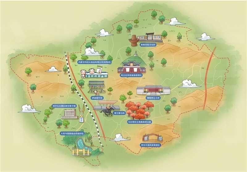
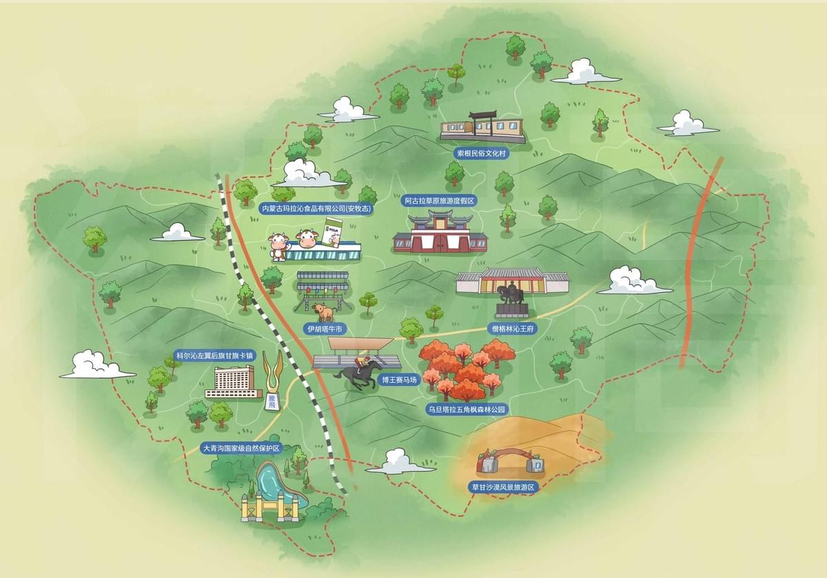
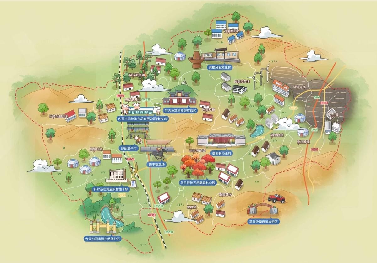
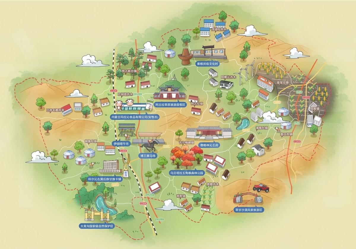
- First came the base map with subtle terrain features and clear boundary lines
- Next, we integrated the road network, distinguishing main routes with solid lines and tourist paths with red dashed lines
- Landmark illustrations were carefully crafted for:
- Cultural centers and museums showcasing Mongolian heritage
- Tourist facilities and accommodations for visitor convenience
- Traditional Mongolian yurts and dwellings
- Modern infrastructure like the impressive wind farm
- Natural attractions and parks that showcase the region's beauty
- Blue information boxes and yellow location markers were designed for clarity
- Decorative elements—clouds drifting across the sky, trees dotting the landscape, and small character illustrations—were added to bring the map to life
- Typography was selected to balance traditional aesthetics with modern readability
Each element was hand-drawn, creating a warm, personal quality that printed maps often lack.
Beyond Geography: Special Features and Cultural Elements
What elevates a good map to a great one is attention to cultural nuance and special details:
- Cultural authenticity was paramount, with careful representation of traditional Mongolian elements like yurts and horse riding areas
- Environmental awareness was highlighted through the inclusion of the wind farm, showcasing the region's commitment to sustainable development
- Clear pathways and routes were designed with visitor accessibility in mind
- The map balances cultural heritage sites with modern facilities, providing a complete picture of what Kezuohouqi offers
- Artistic touches—the horse statue, character illustrations, and decorative trees—add personality and warmth
- Visual storytelling guides visitors through a journey that unfolds as they explore the banner
These special features transform a functional document into a cultural artifact in its own right.
From Art to Application: Final Production and Implementation
Completing the map required careful attention to its practical application:
- Digital refinement ensured all elements were properly balanced and all labels remained legible
- Stakeholder reviews confirmed the accuracy of locations and cultural representations
- Multiple format versions were created for physical brochures, digital platforms, and on-site displays
- Comprehensive usage guidelines were provided to ensure effective implementation
A Map That Tells a Story
The Kezuohouqi tourism map stands as more than a navigational tool—it's a visual ambassador for a region rich in history and culture. Through warm colors, traditional design elements, and careful illustration, it invites visitors to explore the unique character of this Inner Mongolian treasure.
In creating this map, the Mapful.art team bridged the gap between practical information and cultural storytelling, producing a guide that honors the spirit of a place where heroes mount horses and visitors are always welcome.