Introduction
In a world dominated by digital navigation tools, there's something undeniably charming about hand-drawn maps. They capture not just geography but the essence and character of a place. When the Mapful.art team was commissioned to create a vibrant, tourist-friendly map for Nanyang City's "Tour Nanyang by Car" initiative, they embarked on a journey that blended cartographic precision with artistic expression. This post takes you behind the scenes of their creative process, revealing how they transformed raw geographic data into a delightful visual guide that invites exploration.
Initial Client Consultation
Every successful map begins with clarity of purpose. The Mapful.art team initiated their project with a comprehensive consultation to establish the foundation for their creative work:
- Defining the primary purpose: Creating a tourist-friendly guide highlighting car tour routes through Nanyang's urban district
- Identifying the target audience: Self-driving tourists visiting Nanyang who need a visually engaging overview
- Establishing key attractions: Determining which landmarks, parks, cultural sites, and commercial centers deserved prominence
- Setting style parameters: Agreeing on the cheerful, cartoonish aesthetic with bright colors that would make the map inviting and accessible
This initial phase ensured alignment between client expectations and creative direction, setting the stage for a successful collaboration.
Research and Data Collection
With a clear vision established, the team dove into the research phase—where art meets accuracy:
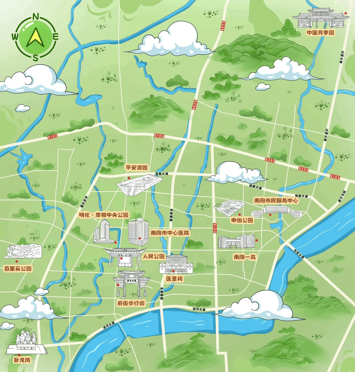
- Geographic precision: Official city maps provided the skeletal structure, ensuring proportions and layouts reflected reality
- Natural features: The city's waterways, parks, and green spaces were carefully mapped, later to be highlighted in refreshing blues and greens
- Cultural landmarks: Historical sites and cultural attractions were identified for special illustrative treatment
- Special elements: The distinctive red flowers that would mark points of interest throughout the map were strategically placed
- Transportation infrastructure: Major roads constituting the "car tour" route were meticulously traced to ensure navigational value
This research phase balanced geographic accuracy with the need to highlight elements that would be most valuable to tourists exploring by car.
Design Concept Development
With raw data in hand, the artistic vision began to take shape:
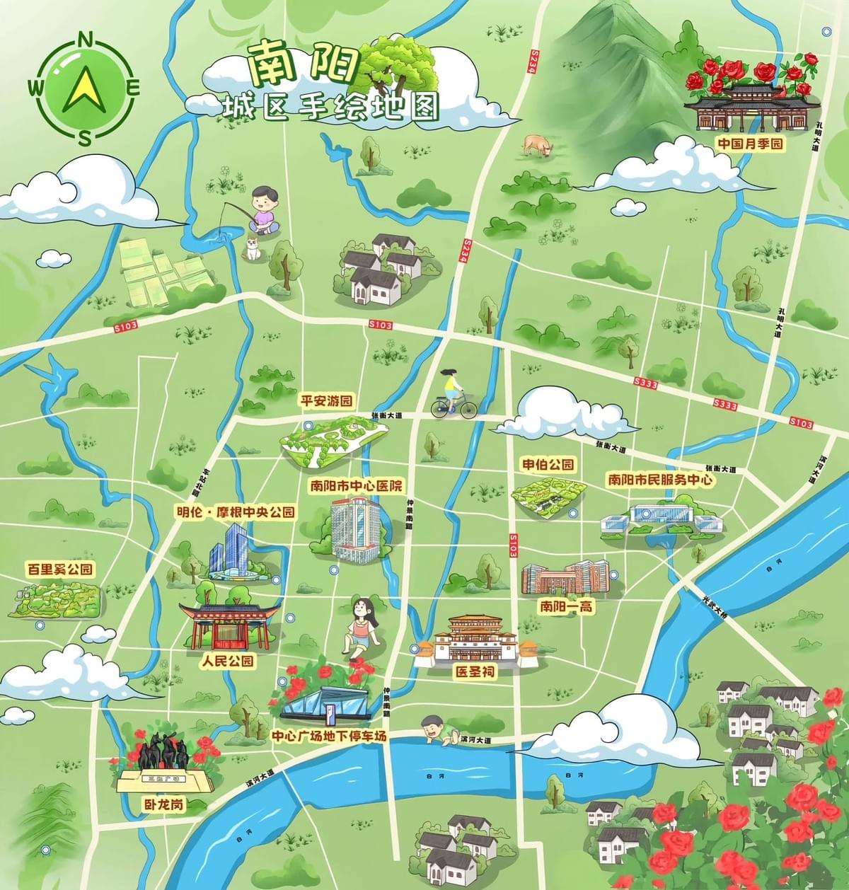
- Visual style guide: The team developed a cheerful, cartoon aesthetic with a predominantly green base representing the city's lush surroundings
- Color palette selection: A fresh cyan blue sky creates a backdrop for the vibrant green landscape, with deeper blues marking waterways
- Illustration approach: Buildings and landmarks were rendered as simplified yet recognizable icons, striking a balance between detail and clarity
- Character elements: Small cartoon figures were strategically placed throughout the map, adding life and suggesting activities for visitors
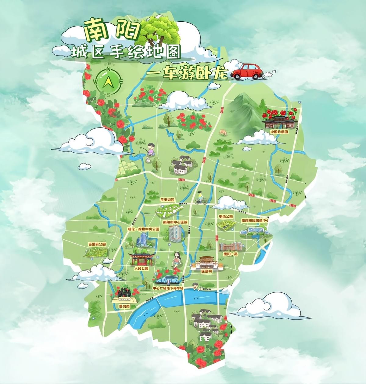
- Border treatment: Fluffy white clouds frame the city district, softening the edges and enhancing the welcoming atmosphere
This conceptual framework guided all subsequent creative decisions, ensuring a cohesive final product.
Technical Execution
The transformation from concept to creation involved several technical stages:
- Base map preparation: The distinctive outline of Nanyang's urban district formed the canvas for all subsequent elements
- Layered development:
- Base terrain: Textured green areas representing the land
- Water features: Blue rivers and bodies of water flowing through the cityscape
- Road network: White pathways with numbered routes for easy navigation
- Landmark illustrations: Key buildings drawn in a recognizable yet simplified style
- Decorative elements: Clouds, flowers, and character illustrations adding visual interest
- Digital illustration techniques: Drawing tablets and professional software enabled the hand-drawn aesthetic while allowing for precise control
- Typography considerations: Friendly, readable fonts for Chinese characters were selected to complement the illustration style without sacrificing legibility
- Navigational elements: A compass rose and other wayfinding aids were incorporated to enhance the map's practical utility
This layered approach allowed the team to build complexity while maintaining visual harmony throughout the composition.
Special Features and Finishing Touches
What transforms a good map into a great one are the distinctive elements that give it character:
- Highlighted tour routes: Clear pathways make the "Tour by Car" theme immediately apparent and easy to follow
- Landmark illustrations: Key buildings rendered in a style that balances recognition with artistic expression
- Decorative red flowers: These visual accents create rhythm across the map while marking points of special interest
- Character integration: Small human figures suggest scale and activities, bringing static geography to life
- Cloud framing: The soft border effect enhances the welcoming atmosphere and focuses attention on the city center
- Balanced information density: The map provides enough detail for navigation without overwhelming its aesthetic appeal
These finishing touches elevate the map from a mere navigational tool to a keepsake that captures the spirit of Nanyang.
Final Production and Delivery
Bringing the project to completion involved several critical final steps:
- Digital refinement: All elements were carefully aligned and visually balanced for maximum impact
- Accuracy review: Locations were verified to ensure correct positioning and labeling
- Multi-format preparation: Versions were created for print materials, digital platforms, and tourist information centers
- Usage guidelines: Recommendations were provided for effective implementation in tourism promotion
Conclusion
The Nanyang City District hand-drawn map stands as a testament to the power of artistic cartography. By blending geographic accuracy with creative expression, the Mapful.art team created more than just a map—they crafted an invitation to explore. The cheerful colors, whimsical illustrations, and clear navigation cues work in harmony to guide visitors while capturing the unique character of Nanyang.