In an era where digital experiences shape our interactions with physical spaces, illustrated maps have become powerful tools for tourism and local discovery. Mapful.Art has recently demonstrated exceptional skill in this domain with their visually stunning Chumen Town Illustrated Guide Map. This blog post takes you behind the scenes of this creative project, exploring how cartography, art, and technology merged to create an engaging user experience.
The Journey Begins: Understanding Client Needs
Every successful mapping project starts with clear objectives. The Mapful.Art team likely initiated their process with a comprehensive consultation with Chumen Town officials. During these initial meetings, they would have:
- Identified the town's tourism objectives and target audience
- Documented key attractions, cultural landmarks, and hidden gems
- Understood the town's unique character and visual identity
- Established technical requirements for the interactive application
This foundational understanding guided all subsequent design decisions, ensuring the final product would serve both practical navigation needs and promotional goals.
Building the Geographical Foundation
Before the artistic elements could be added, Mapful.Art needed to establish geographical accuracy. This critical phase involved:
- Creating a precise base map showing the town's layout
- Mapping the prominent river flowing through Chumen
- Documenting the network of major roads and pathways
- Establishing neighborhood boundaries and districts
- Positioning landmarks in their exact locations
This balance between cartographic precision and artistic interpretation is what makes illustrated maps both useful and delightful.
Developing a Distinctive Visual Style
The Chumen Town map's visual identity is immediately recognizable. The Mapful.Art team crafted a cohesive aesthetic featuring:
- A soothing color palette dominated by greens and blues, reflecting the natural environment
- 3D isometric representations of buildings, creating depth while maintaining clarity
- Simplified yet recognizable landmark designs that capture essential architectural elements
- Color-coded neighborhoods for intuitive district recognition
- Thoughtful typography that remains legible despite the artistic presentation
This distinctive style transforms a standard map into a visual story about Chumen Town, inviting exploration and discovery.
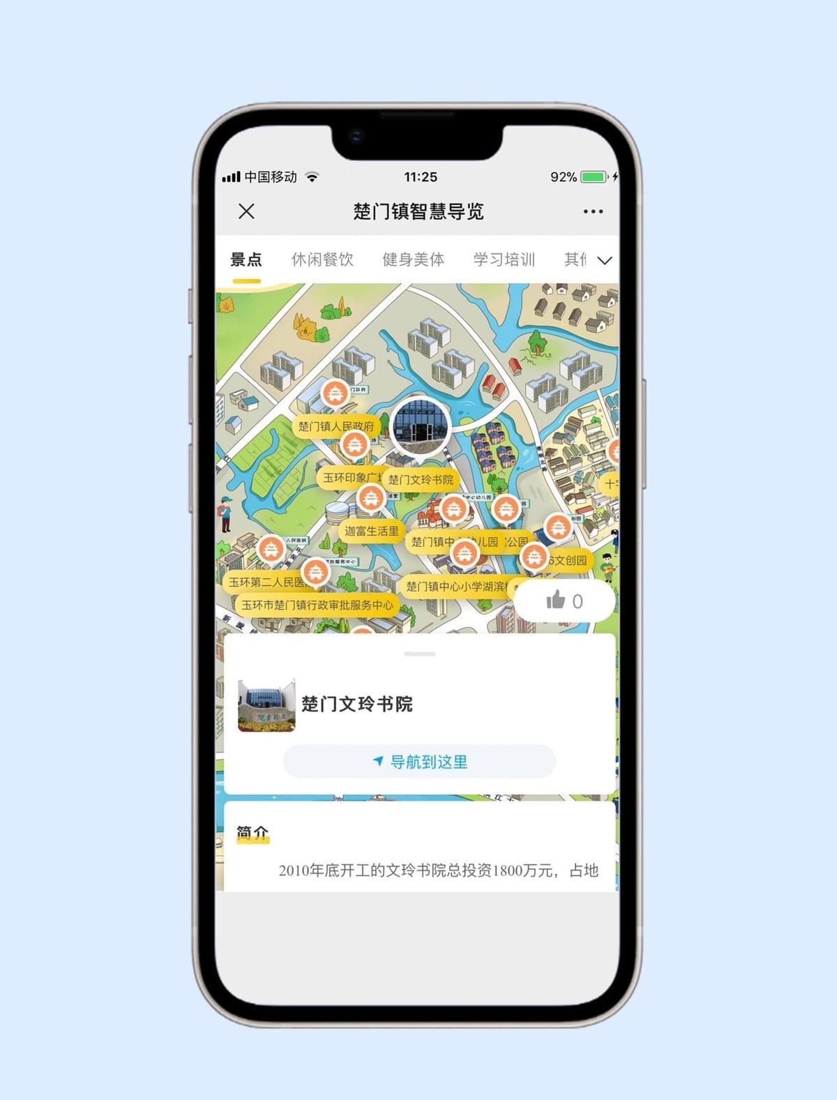
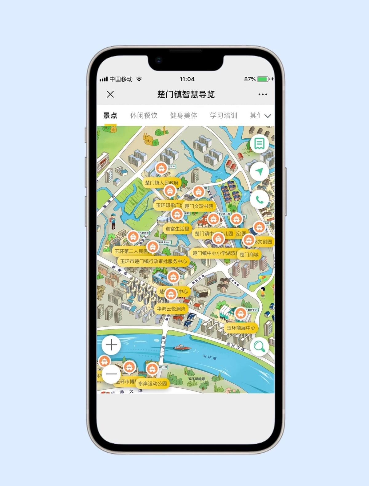
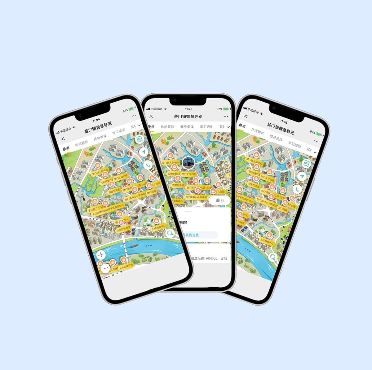
Digital Implementation and Interactive Features
What truly sets this project apart is its transformation from static illustration to interactive experience. The Mapful.Art team implemented several user-centered features:
- Category filtering allowing users to display specific points of interest (attractions, dining, fitness, education)
- Interactive orange circular markers with distinctive icons for different location types
- Tap functionality revealing additional information about each location
- Intuitive navigation controls including zoom, pan, and rotation
- Integration with mobile interface elements for seamless user experience
These technical elements transform what could have been a simple digital image into a powerful tool for exploration.
Design Considerations for the Local Context
Careful attention to cultural and linguistic details demonstrates Mapful.Art's comprehensive approach:
- Bilingual labeling with clear Chinese characters that maintain readability at various zoom levels
- Representation of authentic local architectural styles
- Emphasis on culturally significant landmarks
- Visual hierarchy that guides users to important locations first
- Color schemes and visual elements that resonate with local aesthetic preferences
These thoughtful touches ensure the map feels authentic to Chumen Town's identity while remaining accessible to visitors.
Conclusion: Maps as Digital Experiences
The Chumen Town Illustrated Guide Map exemplifies how modern cartography extends far beyond simple geographic representation. Mapful.Art has created more than just a map—they've developed a digital experience that showcases the town's unique character while providing practical value to visitors.
By combining geographical accuracy, artistic illustration, and interactive functionality, Mapful.Art has demonstrated how digital mapping can enhance tourism, foster local pride, and create memorable user experiences. The Chumen Town project stands as an inspiring example of digital cartography's potential to transform how we explore and connect with places.
As destinations worldwide seek to differentiate themselves and provide memorable visitor experiences, illustrated interactive maps like this one will continue to play an increasingly important role in tourism development and local storytelling.